

Research
Annual Cruise Measurement
The annual cruise determines the size of the annual mid-summer hypoxic zone areal extent, used to assess progress towards achieving their Coastal Goal of reducing the five-year average mid-summer hypoxic zone areal extent to below 5,000 km2 through reducing nutrient pollution. Since 2015, NGI has managed the support for the annual dead zone cruise, a cruise that has led to a critical data set spanning over 30 years. Below is a typical cruise plan.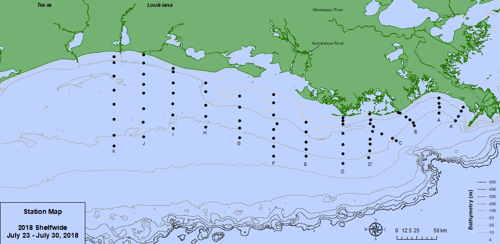
This map shows the sampling transects usually visited during the research cruise.
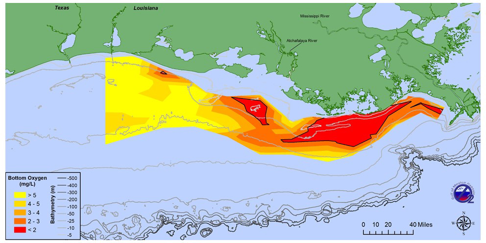
2018 - The bottom area of low oxygen in Louisiana coastal waters west of the Mississippi River, commonly
known as the 'Dead Zone,' was mapped at a smaller-than-average size this summer. The area was 2,720 square
miles (7,040 square kilometers), slightly larger than the state of Delaware and well below the projected
estimate of 6,570 square miles (17,000 square kilometers). Additional details and original image are available at
gulfhypoxia.net.
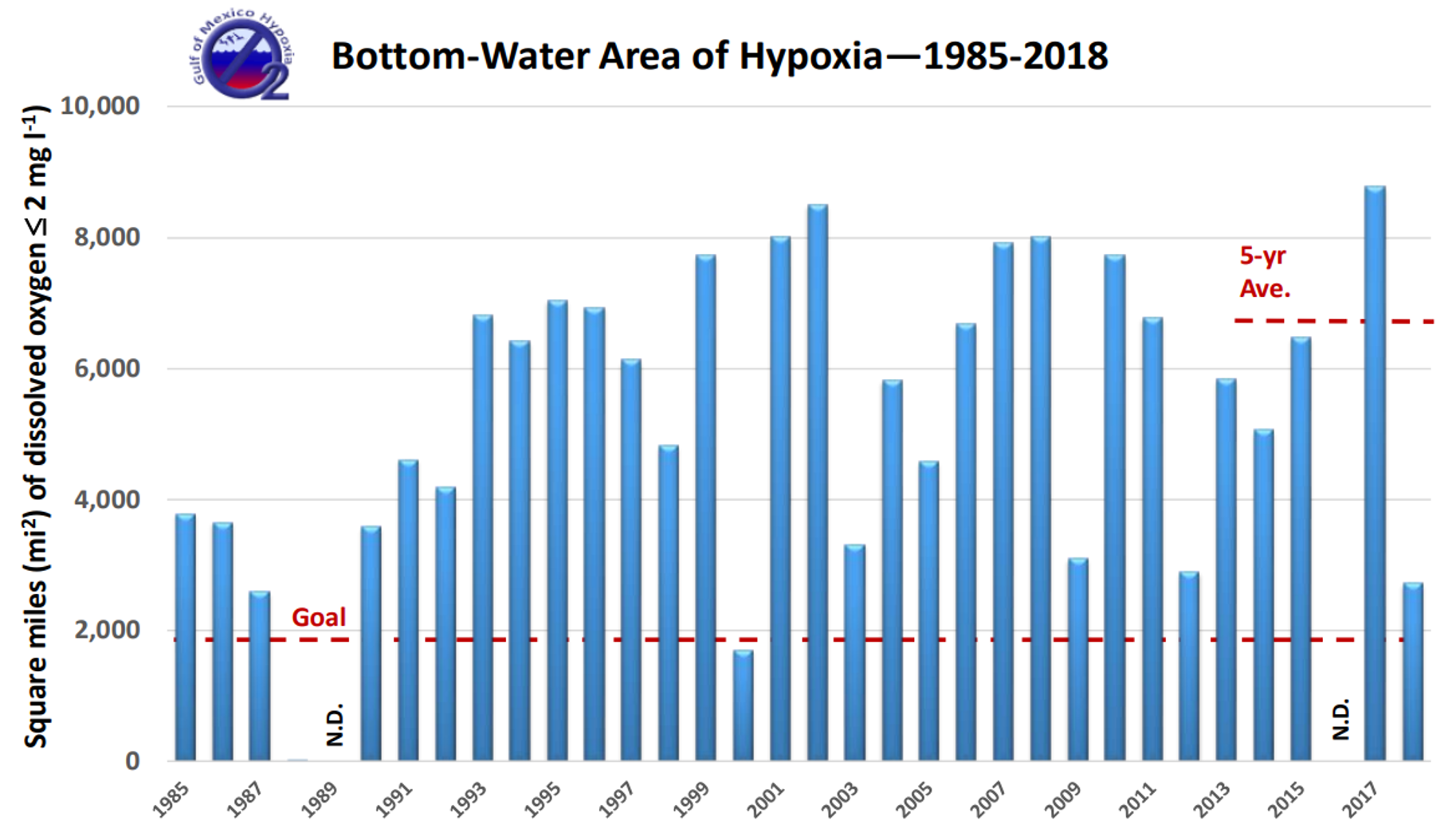
Historic size of hypoxia from 1985 to 2018. There are no data (n.d.) for 1989 and 2016. The value for
1988 is 15 square miles and barely visible on the scale. Find additional details and original image at gulfhypoxia.net.